A fresh look for an old trail brings a new hiking opportunity to Withrow Springs State Park.
The War Eagle Trail has been a favorite of visitors to the Arkansas park located five miles north of Huntsville. The path guided hikers mostly uphill for a mile along the flowing War Eagle River.
Forest, bluffs and overlooks highlighted the trail, which started where Arkansas 23 crosses the War Eagle River on the park's south side. The trail -- being next to the river -- suffered from erosion that occured when the scenic stream becomes a raging, flooded torrent.
Erosion closed the trail. There's no plan to repair it at this time, said Adam Leslie, assistant superintendent at the park.
But a new War Eagle Trail has been built and is open for hiking.
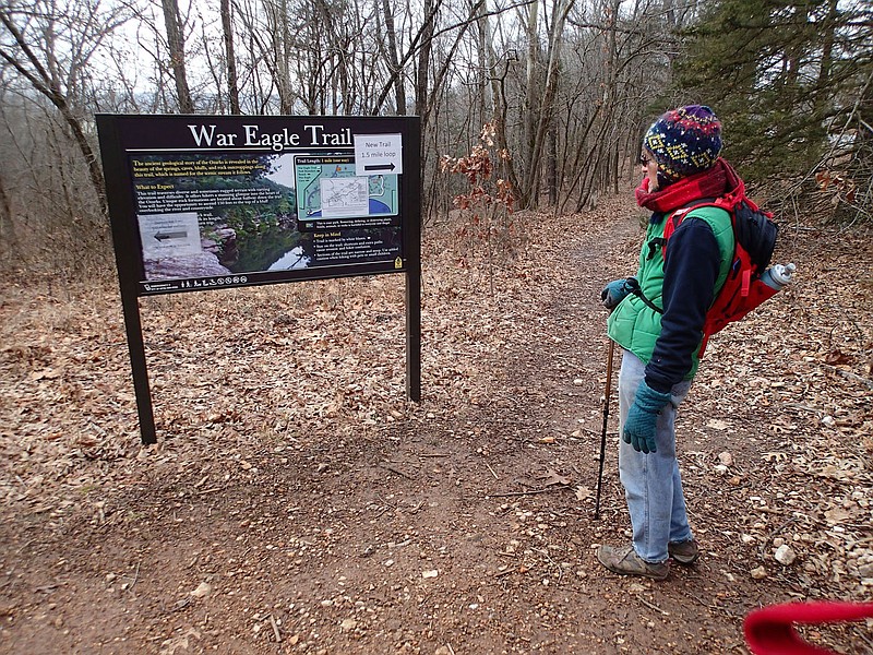
It's a 1.5-mile loop through the forest that starts across Arkansas 23 from the Keith Ham pavilion. The loop is mostly level and easy for hikers of all ability. It's situated on a ridgetop high above the river and occasionally offers peeks at the shimmering water far below.
To start hiking the loop, park at the Dogwood Trail area to the right of the pavilion along Arkansas 23. Look across the highway, slightly to the right, and you'll see a sign for the War Eagle Trail.
For now, the park has tacked up a temporary sign that says, "New trail," but Leslie said permanent trail signs are planned. From here, head out along the trail to the right of the sign. This takes you counterclockwise around the loop.
The first one-half mile runs fairly close to the highway on a westerly course. Midway, it makes a sharp turn and goes east for the rest of the hike. It's on this part that views of the river and War Eagle valley open up.
Close to the end, the trail crosses what appears to be an old farm-pond dam, then joins the original War Eagle Trail. The path heads off to the left along the original trail back to the start.
An Arkansas State Parks trail crew started building the loop in June and finished it in a couple of months, Leslie said. Hikers started using it last summer.
The old one-mile hike from the Arkansas 23 bridge to a bluff top high above the river was nice. Some hikers will no doubt miss it. But it's not a trek everyone could do. There are spots that are downright dangerous for kids. Parts of the old route are perpetually slick and lung-buster steep.
A plus side was tremendous views of the War Eagle River and its valley for careful, experienced hikers.
This new trail "provides a hiking opportunity for everybody. The whole goal was to build a trail that is acceptable to all," Leslie said. It's for feet only, no bikes.
Some cedar trees were cleared by the trail crew at a couple spots to open up views of the river valley. This new trail is much higher above the water than the original War Eagle Trail. On sunny days, the river can be seen here and there shimmering far below.
A great hike at Withrow combines the new loop and the 0.75-mile Dogwood Trail loop. Park at the Dogwood trailhead, next to the pavilion on Arkansas 23. Circle either loop, then the other, for sort of a figure 8 hike of 2.25 miles. Dogwood Trail is rated easy, but there's some short, fairly steep, uphill hiking. Maybe a 6 on the wheezer scale.
Hikers eager for more distance can walk the Forest Trail on the north edge of the park. It's an easy out-and-back trail, 1.1-miles out and 1.1-miles back.
The loop above the river is new, but Leslie said the park plans to stick with War Eagle Trail as its name. The route is a nice addition to the trail network at this lovely state park.
Flip Putthoff can be reached at [email protected]
